Three days each week, our travels take us down Old U.S. Highway 50 past a sign. “St. Patrick’s Church. Emerald Parish. 6 1/2 miles south.” After passing by at least a dozen times, my husband and I gave in to the urge to follow it and turned south.

The sign drawing in visitors from Old U.S. Highway 50.
“Has it been six and a half miles yet?” I asked as we drove down a country road, with only a handful of farm houses in sight.
“I have no idea,” Jim said. “I’m not even sure what county we’re in.”
Suddenly, our road intersected Kansas Highway 31 at an angle and we were looking at a steep hill.
“You think it’s up there?” I said, doubtfully.
“Let’s go see,” Jim said. And we climbed the hill to find one of the most spectacular overlooks in central Kansas.
—
We were, in fact, in Anderson County. Belying its idyllic appearance is a county whose people and history are a touch contrary and more than a little accomplished. Named for attorney Joseph C. Anderson, a leader in the “bogus” pro-slavery legislature that attempted to take control of Kansas, the county would as claim its own one Dr. J. G. Blunt, who, as a major general, was the highest ranking member of the Union army to settle in Kansas. The county would also be the birth place of Edgar Lee Masters, author of the Spoon River Anthology, and Dr. Martha E. Cunningham, one of the first women doctors in the state. And yet, the southeast corner of the county was known to be a hiding place for border ruffians during the Civil War and Jesse James thereafter. It is also believed that the first-ever picture of a tornado was shot from Anderson County.
But this was all in Anderson County’s future. In 1857, when Irish transplant John McManus was looking for somewhere to claim for his family, he saw the cheap land and excellent soil and staked a claim near the Ionthe Creek in Reeder Township.
—
At the top of the hill with its breathtaking panoramic view was a brick, Romanesque church.

St. Patrick’s Church, built in 1899.
“It’s almost all alone up here,” I said, seeing only a decrepit building next to the church.
Yet the church was maintained and, other than the fact that its bell tower had been removed, appeared to still be in use.
—
The McManus family was followed by a wave of others who made their way west after immigrating from Ireland, many from North Ulster. Soon names like Doolin, Collins, McEvoy, Glennan, McElroy, Cristy, McGrath, Reddington, Fitzgerald, Sullivan, McLindon, Campbell, and Grant populated the area. After the Civil War, the Fay, McGlinchy, Cotter, Swallow, Benedum, Hagan, McGlinn, Mooney, and O’Neill families settled into the highest eminence of Anderson County.

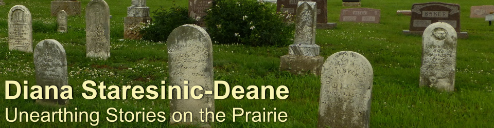
Many of the monuments at St. Patrick’s Cemetery attest to the Irish roots of Emerald’s original inhabitants.
“They built log houses, danced and were happy in a land of boundless opportunities where they were the landlords instead of the tenants as they had been in Ireland,” Harry Johnson wrote in 1936 in his History of Anderson County Kansas.
The Irish settlement, which spread into nearby Coffey and Franklin counties, did prosper. By 1870, they had outgrown the first church and replaced it with a structure built from locally quarried stone. In 1899, they replaced the stone church with the brick Romanesque building that is said to have been decorated by artists from Luxemburg.
“One of the finest church edifices in Kansas,” Johnson wrote, “…this brick structure, built Roman style, forms the nucleus of the Emerald settlement today.”
The area became known as Emerald, and with no town per se, the church, which stood at the settlement’s highest point, served as a beacon to the community’s Roman Catholic population.
—
“Look at this cemetery,” Jim said as we walked behind the church. At a glance, it was clear that we were seeing a prosperous community who could afford substantial monuments to honor their dead. Some family stones were adorned with statues eight feet tall, artistry infused with enough emotion to take your breath away.

The monument honoring the Collins family in St. Patrick’s Cemetery.

A close-up of the angel that stands eight feet tall over the five-foot base of the McGlinchy family monument.
By World War I, Emerald was home to 75 families, and its schools (the final building, St. Patrick’s School, is the empty structure next to the church) produced five lawyers, two doctors, numerous nurses and teachers, and a member of the Kansas Authors Club. Eighteen men from the area would serve in the Great War, two losing their lives.
Then, like so many other rural areas in Kansas, the settlement experienced a population decline beginning during the 1930s. The number of local families dropped to 48, with a slight resurgence after World War II. Despite the decline, many with Irish roots still call this area home, and the church and cemetery are still in use. While the bell was removed from the church roof during the 1990s, it is preserved at the entrance to the cemetery, where visitors can activate the clapper, causing it to resonate a deep, rich sound that can be heard for miles.
At a time when so many Roman Catholic churches are closing their doors due to financial shortfalls and a shortage of clergy, St. Patrick’s Church continues to serve the community of Emerald. Though the settlement may only be a shadow of its former self, at five o’clock each Saturday evening, the church that otherwise sits quietly on the hill is renewed with members from the surrounding farms and ranches.

It took 10 snapshots to build a panoramic view of the sweeping countryside east of the steps of St. Patrick’s Church in Emerald, Kansas.