
On one of our weekend drives to nowhere in particular, Jim and I found ourselves heading east on K-68 and circling the roundabout to exit onto the Old KC Road when we encountered a sign.
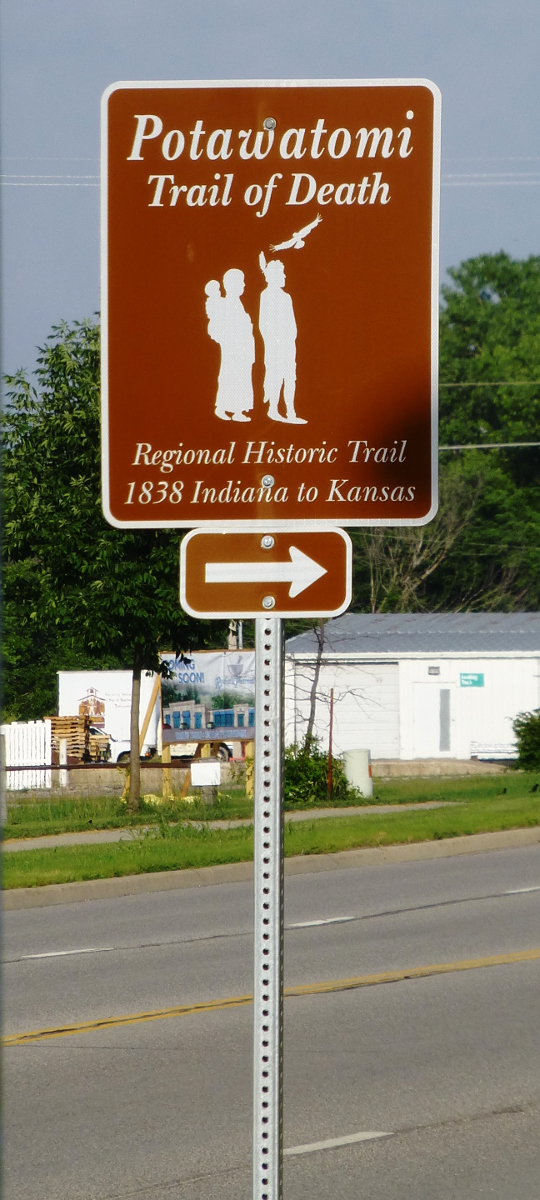
These brown “Potawatomi Trail of Death” signs point the way.
We definitely would have remembered if we had previously encountered signs marked “Trail of Death.” Curious, we turned our destinationless drive into a quest to follow the signs.
We found ourselves at a pretty little green square in Paola, where, serendipitously, a staff member from the Miami County Historical Society happened to be enjoying the early evening sun. She outlined the story of the Potawatomi and how they ended up in Kansas.
Like many Native Americans in the 19th century, the Potawatomi held lands that encroaching settlers wanted. In 1838, two years after signing a treaty that gave away all of their land for $8,000 in exchange for transportation to their new lands, 660 Potawatomi men, women and children were forced to leave their homeland. Mostly on foot, the Potawatomi marched across Indiana, Illinois, and Missouri before reaching Kansas, a trip that would take two months. They lacked proper nourishment and shelter, and despite being tended to by a Jesuit priest named Benjamin Petit, many became ill and died.
When they arrived at the Sugar Creek Mission, they discovered that no houses had been built for them. It was November in Kansas, and the Potawatomi were forced to shelter they best they could along the creek banks.
Fr. Petit became very ill and ultimately died February 10, 1839 after returning to St. Louis.
“You should follow the signs to the park,” the woman from the historical society told us. “The memorial park is worth seeing.”
***
Generally speaking, the signs were easy to follow. They are, however, spaced just far enough apart that you start to worry you missed an important turn somewhere before the next sign appears to reassure you. Travel tip: If you happen to be using the GPS on your cellphone and your cell service is through Sprint, Virgin Mobile, or Verizon, be warned: you WILL lose your signal. Because of this lost signal, I couldn’t get this handy map to work for most of our trip. Also important to note: we picked up the trail near Paola, but the trail begins in Indiana.
We traveled through Osawatomie, which is a historic town that deserves attention all on its own and merits a return trip. A charming bridge takes you across Pottawatomie Creek on the south end of town.
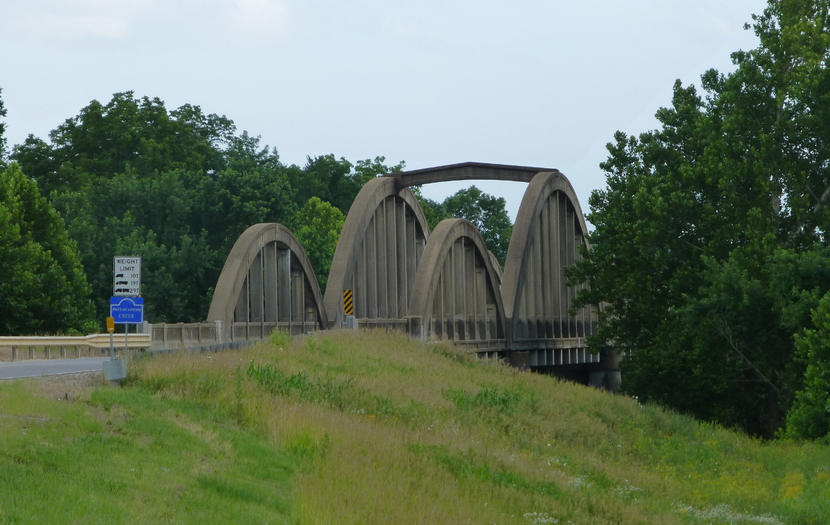
The bridge at the southern end of Osawatomie.
As you approach the tiny town of Beagle, the lack of signage will sorely tempt you to continue following the smooth and silky K-7 Highway instead of continuing south on Plum Creek Road. DON’T DO IT. Otherwise, you’ll find yourself having this conversation:
Diana: Shouldn’t we go straight? There’s no sign that says to turn.
Jim: There’s no sign that says to get off of the main highway, so we should keep following K-7.
Ten minutes later…
Diana: Have you seen any signs?
Ten minutes after that…
Jim: I think maybe we should have gone straight back there.
Diana: I think you might be right.
After Beagle, the signs reappear and and reassure you that you’re on the right path and will take you into Parker before turning south again.
If you’re a taphophile, Goodrich Cemetery is a short detour off the marked path and worth the visit. The cemetery includes at least one CSA Civil War veteran and one likely War of 1812 veteran, as well as many great examples of Victorian hand art. We found it by accident when the Trail of Death road, 1077, was closed for repairs, and we had to detour. Take a left at W 1800 Rd and a right onto Evangeline and you’ll find it. Travel tip: this area is pretty isolated and the west end of the cemetery leads to a woodsy creek area.
At a crook in the road, you’ll turn onto W 1525 Rd. As you grind down the gravel, you’ll be startled by a tiny cemetery on the southeast corner of Flint Rd and W 1525 Rd. There are only three headstones, but they’re worth examining.
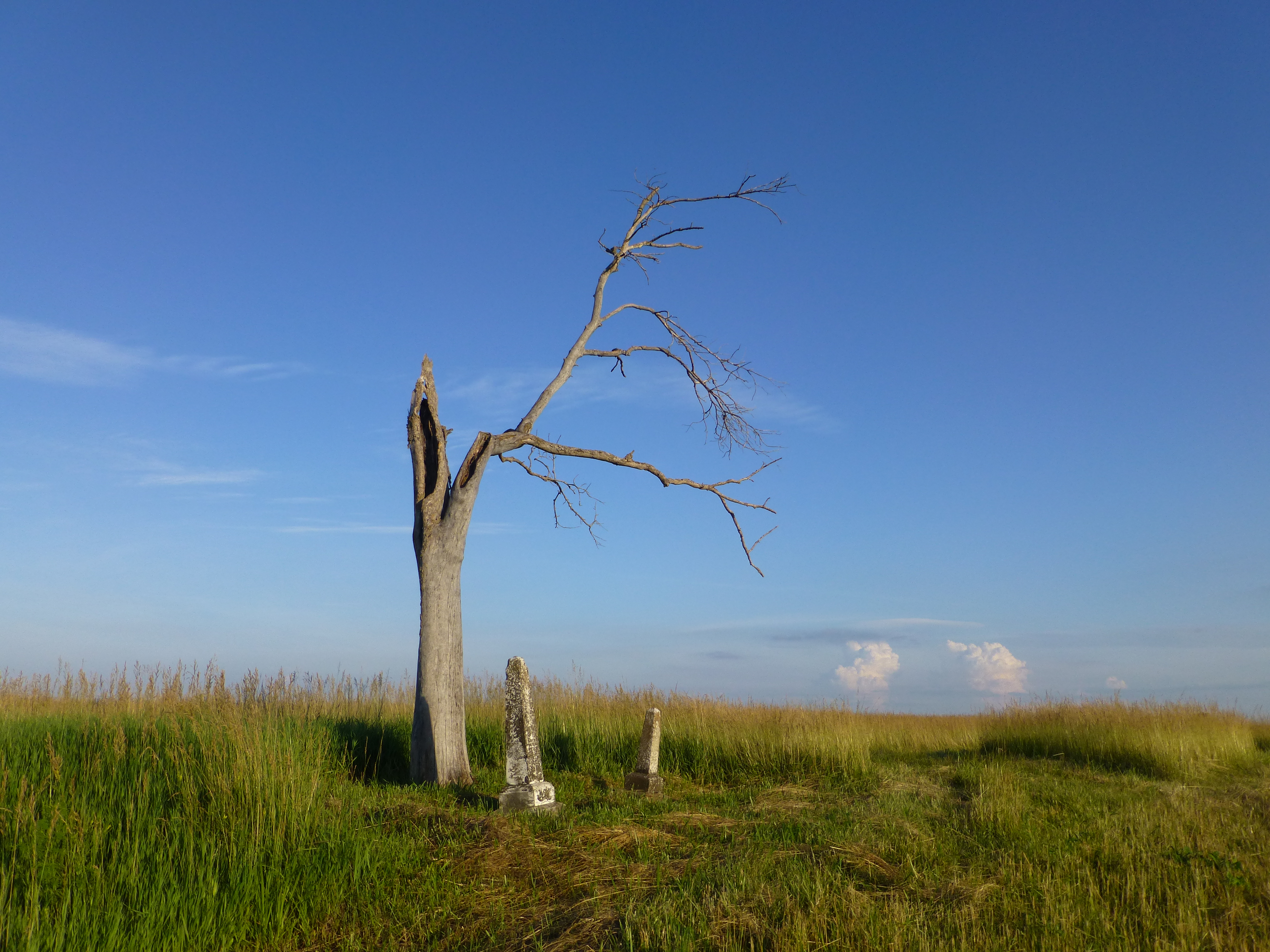
The Sharp-Morrison Cemetery on W 1525 Rd in Linn County, Kansas.
Another mile or so east, and you’ll see the entrance to St. Philippine Duchesne Memorial Park, which stands on the land once occupied by the Sugar Creek Mission.
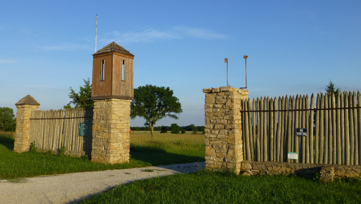
St. Philippine Duchesne Memorial Park.
Jim and I were gobsmacked by this park.
Owned by the Archdiocese of Kansas City, Kansas, this park honors the Native American, Jesuit, and archeological history of the land. The foundations and locations of buildings are carefully marked with informative signs. The park’s sainted namesake was once a nun serving the Potawatomi community at this site.
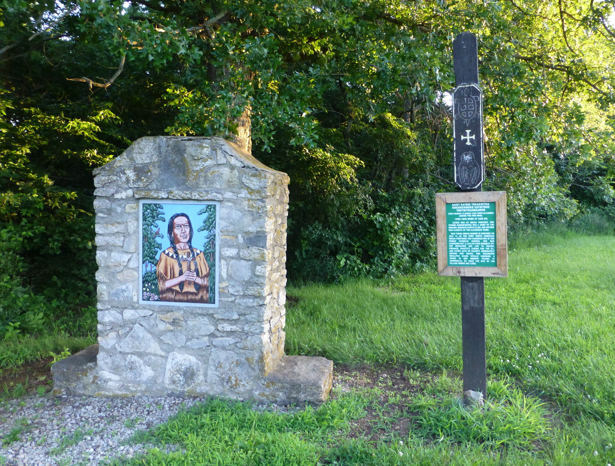
Beautiful memorials and art honor both the Jesuit and Native American men and women who once lived here. This memorial honors Saint Kateri Tekakwitha, an Indian princess who was canonized in 2012.
A nature trail winds through the eastern side of the park. A fabulous discovery: the only known portion of the original Fort Scott and California Road is preserved in this hiking trail. Travel tip: When we arrived at this park last summer, we discovered the words “Beware of Ticks” scrawled on a paper plate and nailed Roanoke-style to the meeting hall wall, so we stayed away from the hiking trail that day. Winter or early spring might be a better time to explore the area under the canopy of trees.
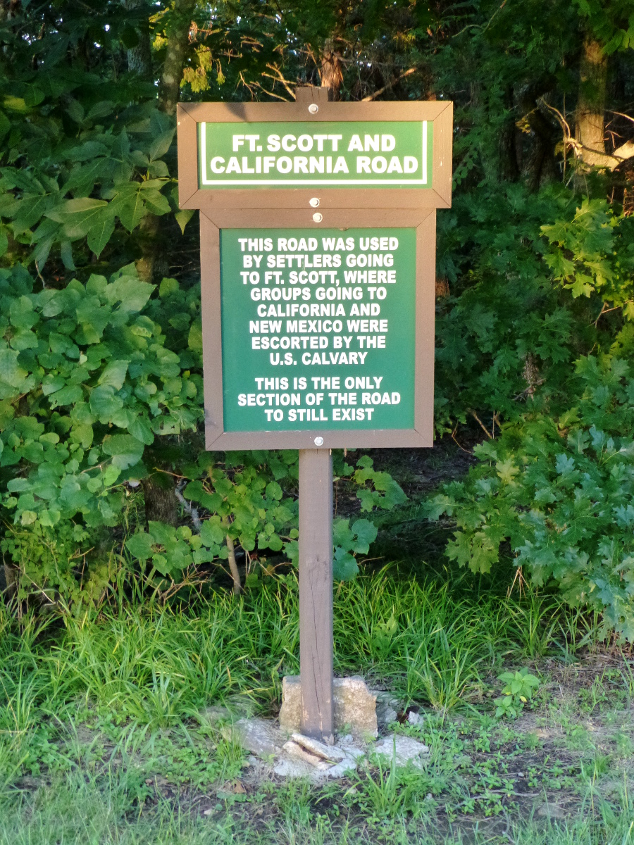
This sign marks the post of the only remaining fragment of the original Fort Scott and California Road.
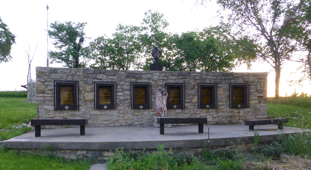
I was most moved by the burial ground. Each of the crosses lists the names of the more than 600 Potawatomi men, women, and children who died at Sugar Creek.
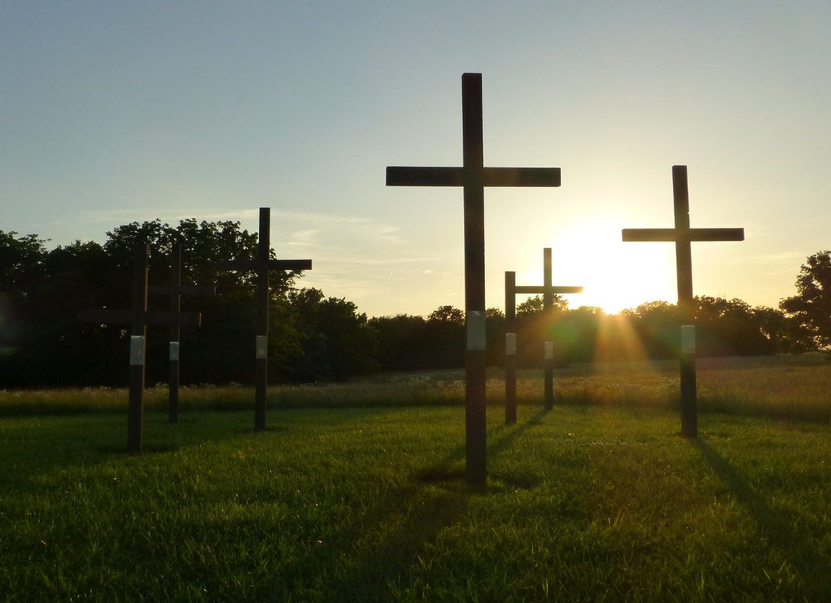
Memorial crosses mark the area where more than 600 Potawatomi are buried.

The names of every man, woman, and child are listed on the memorial crosses.
As we followed the path back to the entrance of the park, we found two more surprises. The first was an archeological site marking what might be a rock pit originally constructed by the Kanza Indians.
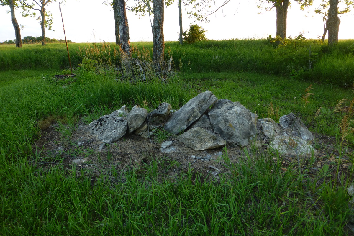
This rock pit may have been constructed by the Kanza Indians.
The second was the text of the diary of Jesse C. Douglas, enrolling agent, who documented the struggles of the Potawatomi on their long journey to Kansas.
Jesse Douglas’s trail journal is preserved in a series of panels at the park.
The Archdiocese of Kansas City, Kansas, has manged to create a spirtual space that honors the individual men, women, and children who tried to make a life for themselves at the Sugar Creek Mission. There is a serene quality here that I have not found in many Kansas parks. There is no charge to visit, but the park does accept donations. It is one of my favorite accidental discoveries and I recommend it whenever I can.
***
What happened to the Potawatomi?
Despite building a settlement, the Potawatomi would not stay in Linn County for long. Just ten years later, the Native American band would be forced to move again, this time to St. Marys, a small town near Topeka, Kansas.
Further reading:
Trail of Death, Miami County Historical Society
